Every parcel of land in the Garden State from a single family home in suburban Cherry Hill to a high rise condominium unit along the Hoboken waterfront is tracked using a highly standardized, rigid identifier system. Unlike general street addresses, which can change or share overlapping names, New Jersey’s land record tracking infrastructure relies completely on alphanumeric designations, Blocks, Lots, and Qualifiers. This geographic identification architecture serves as the foundation for the state’s official NJ MOD-IV tax system data search infrastructure. If you are a real estate investor pulling public valuation metrics, a homeowner trying to audit your annual structural appraisal, or a surveyor plotting property lines, learning how to accurately decode these unique identifiers is absolutely critical.
Decoding the Foundation, What are Blocks and Lots?
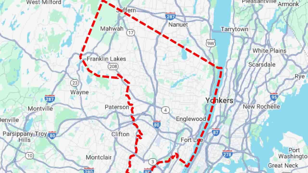
At its core, New Jersey’s property tracking system mirrors a giant grid mapped out across the state’s 21 counties and 564 municipalities. The state Department of the Treasury mandates that every local assessment district maintain a highly accurate, updated municipal tax map that explicitly visualizes these boundaries.
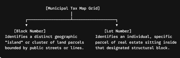
When local assessors or title companies perform a parcel look up, they format these numbers as a continuous sequence. For example, a home listed on an official tax roll might be designated as Block 4105, Lot 12. Together, these two figures create a specific legal anchor point for that land area.
What is a Property Qualifier Code in New Jersey?
While a standard Block and Lot combination works perfectly for a traditional single family suburban home, it falls short when dealing with complex real estate developments. To solve this, the state integrates an extra data layer into the database. The Property Qualifier Code.
So, what is a property qualifier code in New Jersey? It is a supplemental alphanumeric string appended to the primary Block and Lot layout. Its main structural purpose is to make a specific parcel record entirely unique when multiple independent properties occupy the exact same geographic footprint or share identical land space.
Common MOD-IV Qualifier Code Classifications
The Division of Taxation utilizes standardized, single letter or short alphanumeric indicators within the backend MOD-IV tax list layout to flag specialized property structures.
| Qualifier Code Pattern | Real Estate Property Structure | Operational Data Application |
| CXXXX (e.g., C0101) | Condominium Unit | Isolates an individual condo unit’s interior air space from the shared structural building. |
| QFARM | Qualified Farmland | Triggers special assessment rules for working agricultural acreage under the Farmland Assessment Act. |
| T (e.g., T01) | Cell Tower Facility | Separates commercial cellular equipment assessments from the underlying physical ground lease. |
| B (e.g., B02) | Outdoor Billboard | Tracks independent advertising structures sitting on a commercial parcel. |
| BLDG / LOT | Split Assessment | Used when the physical building structure is owned and taxed separately from the actual underlying ground land. |
Step by Step Guide, How to Find Your Block and Lot Number
If you need to look up public records, analyze parcel boundaries, or execute a local tax lookup, you can locate your property’s specific identifiers through three official data pipelines.
Step 1. Examine the Chapter 75 Card or Annual Property Tax Bill
The easiest way to track your parcel data is to pull your latest municipal paper record. Your green Chapter 75 Assessment Notice Card (mailed every February) and your quarterly tax bills feature your specific Block, Lot, and Qualifier codes clearly printed at the top of the document.
Step 2. Utilize a County Parcel Identifier Map (GIS Spatial Data)
If you do not have a physical bill on hand, you can leverage electronic mapping tools. Every county across New Jersey manages an interactive county parcel identifier map through a Geographic Information System (GIS) spatial data network.
- Go to your local county or state GIS data clearinghouse website.
- Zoom into your property’s interactive spatial boundary or enter your standard street address.
- Click directly on the highlighted parcel boundaries. The interactive map layer will generate a pop up tracking window displaying the exact Block, Lot, and Qualifier values tied to that specific coordinates footprint.
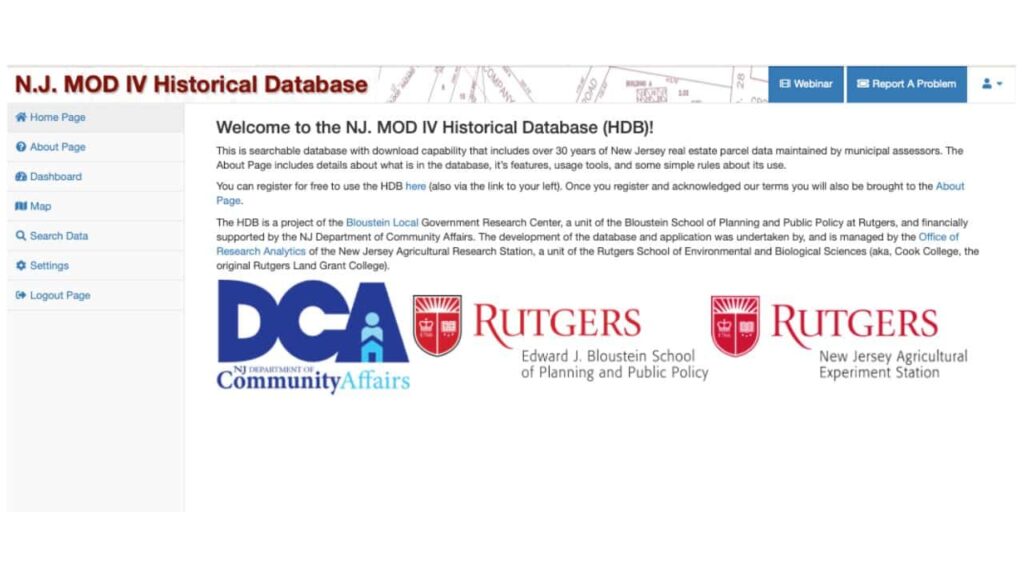
Step 3. Access the Public NJ MOD-IV Portal
For a deep dive into historical valuation records, users can access public lookup databases. This allows you to cross reference addresses against official state information.
- Select the correct county and specific municipality dropdown menus.
- Input the street name to generate a complete list of matching structural properties, detailing ownership names, land dimensions, and historical assessment changes.
Understanding the PAMS_PIN and Automated Data Audits
For advanced web applications, GIS developers, and mapping engines, the data points listed above are concatenated into a single, seamless string known as the PAMS_PIN.
The PAMS_PIN is built by blending the four digit county/municipal district code, the five digit block string, the five digit lot string, and any existing property qualifier characters into a unique tracking string (e.g., 0905_222_6_C0101).
Data Integrity Warning. Search engine crawlers and automated database engines utilize these integrated database pins to execute routine, algorithmic audits of real estate platforms. If your online property records show mismatched or broken structural data such as a missing condo qualifier or an invalid block suffix your content risks losing indexation and organic search ranking authority due to a perceived lack of technical accuracy.
Conclusion
Understanding the structural components of New Jersey’s property data identification system is an absolute prerequisite for successfully executing real estate research. Whether you are using a county parcel identifier map to clarify exact boundary coordinates or analyzing complex easement qualifiers on commercial properties, knowing how to find block and lot number for NJ property records keeps you grounded in verified, official fact sets. By understanding how the NJ MOD-IV tax system data search categorizes real estate components, you can bypass address matching errors, streamline your title searches, and effortlessly protect your legal data pipelines.
FAQs
How to find block and lot number for NJ property records?
You can easily locate these numbers at the top of your green Chapter 75 Assessment Card, your quarterly property tax bills, or by searching your local county’s interactive GIS parcel map.
What is a property qualifier code in New Jersey real estate?
A qualifier code is a unique alphanumeric tag added to a Block and Lot designation to isolate specialized properties like condominiums (C), cell towers (T), or qualified farmland (QFARM).
What exactly is the NJ MOD-IV tax system data search?
It is New Jersey’s official, standardized statewide database framework used by tax assessors to manage, update, display, and archive property characteristics, ownership data, and annual tax assessments.
Why does my property lookup require a Block and Lot instead of an address?
Mailing addresses can change, feature duplicate street names, or overlap. Blocks and Lots provide an unchanging, permanent geographic anchor on the official municipal tax map.
What does a “C” qualifier mean in a property identifier code?
A “C” prefix followed by numbers (like C0004) indicates a condominium unit. This allows the state to issue a distinct tax assessment bill for that specific interior unit.
Where can I look up a county parcel identifier map online?
You can access these spatial data platforms for free through official county web portals or the New Jersey Geographic Information Network (NJGIN) open data directory.
What does “QFARM” stand for on a New Jersey tax list?
It stands for Qualified Farmland. This qualifier tells the automated MOD-IV database to apply special, reduced assessment valuation parameters based on active agricultural production metrics.
Can a single property have multiple Lot numbers in New Jersey?
Yes. If a home sits across multiple distinct plotted parcels, the assessor might list it under a primary lot number while note taking the addition lots on the tax roll.
What happens if a property identifier code contains a decimal point?
Decimals (like Block 104.01) indicate a block or lot suffix, which occurs when an original large land parcel is legally subdivided into smaller, separate pieces over time.
What is a PAMS_PIN inside New Jersey public land databases?
A PAMS_PIN is a long, concatenated identification string that merges the local municipal code, block number, lot number, and qualifier tag together to form a unique database key.