In the modern New Jersey real estate landscape, the difference between a high yield acquisition and a catastrophic liability often comes down to one thing, Spatial Intelligence. For years, institutional investors held the upper hand by accessing proprietary GIS (Geographic Information System) data. In 2026, however, the playing field has leveled. To succeed in the Garden State, you no longer just “look at a property”; you audit its digital footprint. From understanding NJDEP GeoWeb environmental overlays to working through local municipal zoning layers, these interactive maps are the backbone of professional due diligence. This guide breaks down the essential digital resources every serious NJ investor must understand.
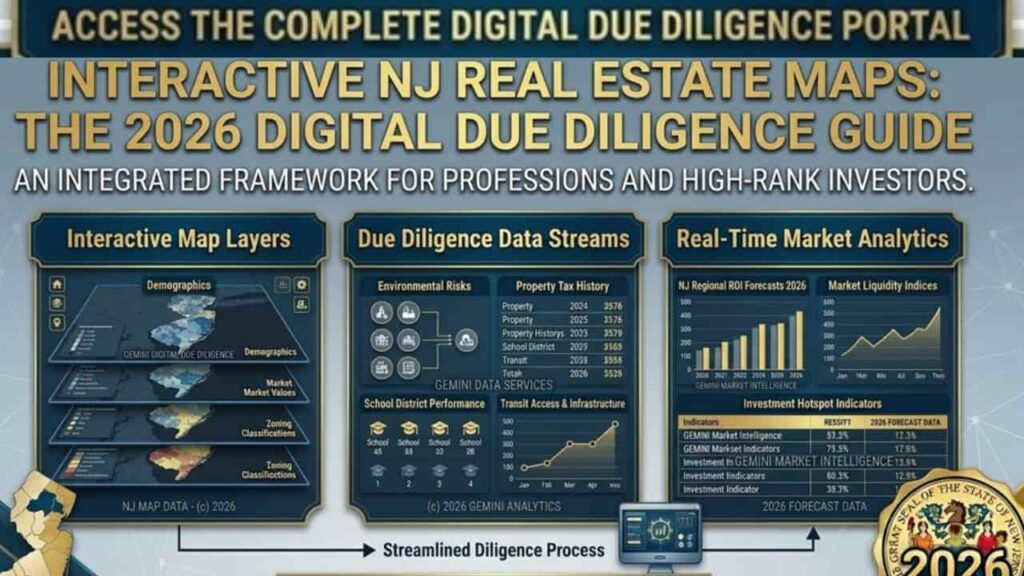
The Pillars of NJ Mapping, Why Static Surveys are Obsolete
A static property survey tells you where the fences are, but an interactive map tells you what the future holds. In New Jersey, land use is governed by the Municipal Land Use Law (MLUL), which often intersects with state level environmental mandates. By using digital maps, you can identify “Red Flags” such as flood zones, wetlands, or restrictive zoning before spending a dollar on an appraisal or inspection.
Essential Mapping Tools for Investors
| Tool Name | Primary Function | Best For |
| NJDEP GeoWeb | Environmental and Land Use Overlays | Identifying wetlands, flood hazards, and contaminated sites. |
| NJ Property Fax | Parcel and Tax Assessment Data | Quick lookups of ownership history and tax assessments. |
| Municipal GIS Portals | Local Zoning and Planning Maps | Verifying specific townlevel bulk requirements and setbacks. |
1. NJDEP GeoWeb, The Gold Standard for Environmental Audits
The New Jersey Department of Environmental Protection (NJDEP) GeoWeb is perhaps the most powerful free tool in an investor’s arsenal. It allows you to toggle layers that reveal the “hidden” geography of a lot.
How to Use GeoWeb Like a Pro.
- Wetlands Layer.
Critical for “raw land” investors. If the GeoWeb shows Freshwater Wetlands (LULC), your buildable area may be significantly less than the total acreage. - Flood Hazard Areas.
With 2026 climate regulations, checking the FEMA Flood Map integration is mandatory for insurance and financing purposes. - Known Contaminated Sites (KCS).
Essential for commercial investors. This layer identifies sites with ongoing remediation or legacy industrial issues. - CAFRA Boundaries.
If you are investing in coastal areas like Toms River or Asbury Park, you must check if the property falls under the Coastal Area Facility Review Act (CAFRA).
2. Municipal GIS & Zoning Maps, Understanding “Home Rule”
New Jersey is a “Home Rule” state, meaning every one of the 564 municipalities has its own zoning code. Most major towns now provide interactive GIS (Geographic Information System) Portals.
Strategic Use of Local Maps
Towns like Jersey City, Newark, and Princeton provide interactive maps that go beyond simple boundaries.
- Zoning Districts.
Identify if your lot is in a residential (R-1), commercial (C-1), or mixed use (MXD) zone. - Redevelopment Areas.
These are “Gold Mines” for investors. Properties in these zones often qualify for tax abatements (PILOTS) and have more flexible zoning standards. - Historic Districts.
Beware of the “Historic” layer. If your property is in a designated district, even minor exterior changes may require a grueling approval process from the Historic Preservation Commission.
3. The NJ Transit Oriented Development (TOD) Map
For 2026 investors, Transit Oriented Development is the strongest trend in the state. Properties within a half mile of an NJ Transit station often see higher appreciation and qualify for reduced parking requirements a massive benefit for mixed use developers.
- Step by Step Audit. Use the NJ Transit station map and overlay it with local zoning to find “under improved” lots in high traffic commuter hubs.
Technical Checklist, Performing a Digital Site Audit
Before you sign a contract of sale, your “Land Use Team” should follow this professional mapping sequence.
- Verify Parcel Boundaries.
Cross reference the municipal tax map with the digital parcel layer to check for encroachments. - Check Impervious Coverage Limits.
Use the map’s measurement tool to estimate the current footprint. If the lot is already at its max lot coverage, you cannot expand without a variance. - Identify Riparian Zones.
Check for streams or water bodies. NJDEP “Buffer Zones” can extend up to 300 feet from a waterway, effectively freezing development in that area. - Utility Infrastructure.
Look for layers showing sewer and water lines. A lot without public sewer access requires a septic “Perc Test,” which can be a deal breaker.
The 2026 Advantage, Real Time Data Integration
In 2026, many NJ mapping tools have integrated AI driven predictive analytics. Some advanced local portals now show “Potential Build Out” scenarios based on current Municipal Land Use Law (MLUL) parameters.
Expert Insight. “Don’t just look at the property today. Use the ‘Planning & Development’ layer on municipal maps to see what your neighbors are building. A vacant lot next door might have a 5 story mixed use project already in the ‘Pending’ queue.”
NJ Real Estate Development & Zoning, Essential Agency Contact Directory
In the New Jersey real estate landscape, your “Land Use Team” must coordinate with multiple state level and regional agencies to secure entitlements and verify environmental compliance. Below is the authoritative contact directory for the primary departments involved in the zoning and development process.
Official Agency Contact Matrix
| Agency / Department | Physical & Mailing Address | Contact Channels |
| NJDEP Bureau of GIS (BGIS) | 401 East State Street, 1st Floor, P.O. Box 420, Trenton, NJ 08625 | Phone: 609-777-0672 Fax: 609-292-7900 Email: GISNET@dep.nj.gov |
| Division of Land Resource Protection (DLRP) | 501 East State Street, P.O. Box 420, Trenton, NJ 08625 | Phone: 609-777-0454 Fax: 609-777-3656 Email: DLRP_Info@dep.nj.gov |
| Bureau of Tidelands Management | 401 East State Street, P.O. Box 420, Trenton, NJ 08625 | Phone: 609-292-2573 Fax: 609-633-3646 Email: Tidelands_Info@dep.nj.gov |
| NJ Site Remediation Program (LSRP) | 401 East State Street, P.O. Box 420, Trenton, NJ 08625 | Phone: 609-292-1250 Fax: 609-777-1914 Email: srp_spill@dep.nj.gov |
| NJ Department of Community Affairs (DCA) | 101 South Broad Street, P.O. Box 800, Trenton, NJ 08625 | Phone: 609-292-6420 Fax: 609-984-7695 Email: dca.feedback@dca.nj.gov |
| NJ Transit Village Initiative (TOD) | One Penn Plaza East, Newark, NJ 07105 | Phone: 973-491-7000 Fax: 973-491-8218 Email: transitvillage@njtransit.com |
Department Functional Overview
- Bureau of GIS (BGIS).
Provides technical support for interactive mapping tools like NJDEP GeoWeb and manages digital parcel data. - Land Resource Protection (DLRP).
Oversees permits for freshwater wetlands, flood hazard areas, and coastal (CAFRA) development. - Site Remediation Program.
Manages the oversight of contaminated sites and ISRA compliance for commercial property transfers. - Tidelands Management.
Handles grants and licenses for any development occurring on land that is currently or formerly flowed by the tide. - DCA (Community Affairs).
Manages the NJ Opportunity Zone program and oversees the Residential Site Improvement Standards (RSIS).
Expert Professional Tip
When initiating contact with any state agency regarding a specific property, always have your Block and Lot numbers and the County/Municipality ready. This ensures the representative can access the specific digital records via the MOD-IV tax database immediately to assist you.
Conclusion
In the 2026 New Jersey market, spatial data is the ultimate hedge against investment risk. Understanding land use without NJDEP GeoWeb or Municipal GIS is equivalent to operating without a compass, digital literacy has evolved from a convenience into a mandatory asset class. By understanding these interactive frameworks, you mitigate 90% of liabilities related to environmental overlays and zoning constraints. In the Garden State, the highest returns are reserved for those who leverage high resolution data to identify the “highest and best use” before the competition.
FAQs
What is the most accurate tool for checking NJ property boundaries?
While interactive maps provide excellent guidance, the Municipal Tax Map is the official record for parcel boundaries. For legal construction or boundary disputes, a physical survey by a licensed NJ Land Surveyor is still mandatory.
How do I use NJDEP GeoWeb to find wetlands on a property?
Open NJDEP GeoWeb, go to to the “Layers” menu, and select Land Use/Land Cover. Look for “Freshwater Wetlands” overlays. If these appear on your lot, you will likely need an NJDEP Letter of Interpretation (LOI) before building.
Are NJ interactive zoning maps legally binding?
No. Interactive maps are for informational purposes. Always cross reference map data with the town’s written zoning ordinance and the Official Zoning Map kept at the Municipal Clerk’s office to confirm “as of right” building permissions.
Where can I find flood zone maps for New Jersey in 2026?
The most reliable source is the FEMA Flood Map Service Center. However, NJDEP GeoWeb also integrates FEMA data and NJ specific flood hazard layers, which are often stricter than federal standards.
How do I check if a property has an environmental “LSRP” oversight?
Use the NJDEP DataMiner tool or the “Known Contaminated Sites” layer in GeoWeb. This identifies if a Licensed Site Remediation Professional (LSRP) is managing a cleanup on or near the property.
Can I see property owner information on NJ GIS maps?
Most NJ Municipal GIS portals (like those in Jersey City or Newark) link directly to the MOD-IV Tax Assessment database, providing owner names, last sale price, and annual tax assessments.
What is a “Riparian Buffer” and how do I spot it on a map?
A Riparian Buffer is protected land along water bodies. On NJDEP GeoWeb, these are usually found under “Water” or “Surface Water Quality” layers. Development within 50, 150, or 300 feet of these zones is strictly regulated.
Is there a map for NJ “Opportunity Zones” for tax benefits?
Yes. The NJ Department of Community Affairs (DCA) provides an interactive map showing designated Opportunity Zones where investors can benefit from capital gains tax deferrals.
How do I find Transit Oriented Development (TOD) zones?
Search the NJ Transit Village Initiative map. Properties within these designated “Transit Villages” often enjoy streamlined permitting and reduced parking requirements under local zoning.
What does the “Impervious Coverage” layer tell an investor?
It shows how much of the lot is covered by non porous surfaces (roofs, pavement). If the map shows a property is at its maximum coverage limit, you cannot build additions or new structures without a Bulk Variance.